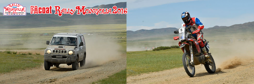
■ETAP-1
7 AUG. 2016 ULAANBAATAR⇒SAYHAN OVOO
L:49.91km S:287.02km L:6.35km S:226.17km L:17.56km TOTAL:587.01km
「Going to meet the grassland elves (fairies)」
The start of the SS or special stages of the 2016 Rally Mongolia is set right at the point where the grasslands start to spread out south along the horizon from Ulaanbaatar. This city also known as Ulaanbaatar has experienced amazingly rapid growth over these last 20 years. The grasslands ripple in waves of lush color, and once we really start running its beauty and lushness give a small cry of welcome you can feel deep inside. Heading further south we reach our SS-1 goal and then make a big course change to the west starting out on SS-2. The grasslands now become really mixed with sand as we proceed to the area called the Gobi. The sun is strong and fierce throwing light to the left of the direction we are heading and then forming deep shadows on our right. If we don’t hurry we will have to battle the glare of the setting sun! We next cross a number of dry riverbeds and reach our goal in a small village in the middle of a parched region.
■ETAP-2
8 AUG. 2016 SAYHAN OVOO⇒SAYHAN OVOO
L:24.38km S:192.99km L:6.90km S:274.32km L:18.07km TOTAL:516.66km
「The lost holy grounds of the lama」
We spend two nights here in this valley camp. The other side of this valley once had a town long ago where people lived together along with some 1,500 monks. Now it has been abandoned and traces of that past life still remain in the historical ruins there. Walking around and taking a look there is a real experience. The scene there while lit by the light of the setting sun sets a special tone that moves one’s heart. In the days of the former Soviet Union the monasteries of the lama were severely persecuted and almost all of them were abandoned. Today will prove the highlight of the first half of the rally. All the rally cars start out simultaneously and we keep driving intently in the great plains to the south. Today’s course is an extremely high speed route. A town just visible at the end of the prairie is the rally CP. The SM class separates from the rally course at this check point (CP). The rally route again passes close to town and we then pass through valleys joined by trees that are quite rare in the Gobi, we will finally arrive at a town in the southern Gobi desert. The SS-1 will end at this town. After refueling, SS-2 starts from alongside a small airfield. The Gobi highway scenery gets more beautiful and lusher the further north we go. We reach the SS-2 goal set up just before the town there. At the liason (untimed section of route) we cross a river and refuel after passing through town.
■ETAP-3
9 AUG. 2016 SAYHAN OVOO⇒BAYANHONGOR
S:177.71km L:33.06km S:258.54km L:17.89km TOTAL:487.20km
「Heading to the western region along the road through the valley」
SS-1 starts right from the bivouac. Moreover we also cross a river that lies right beyond the start gate so most of the gallery watchers in the bivouac area no doubt gave us a thunderous burst of applause when they saw us. Finally we find ourselves running through the mountains and if we can just get through an area where navigation is a little difficult we will reach the high-speed piste. The short SS-1 ends just before a paved road. The SM class heads toward Bayanhongor from there via this paved road.
The SS-2 cars then head south on the high-speed piste, we make a CAP (compass heading) change at the town there and get back on the highway.
The piste on the left end that we took gradually separates from the highway and we eventually reach a small village. The left route enters the mountains from here. We leave the valley but the cliffs are high around here. We move ahead very slowly and cautiously. After passing through a number of valleys we emerge into an area where the grounds widens into a surface covered by volcanic rock. These are jagged, pointy rocks so we drive along carefully spending a lot of time to pass through the area without getting flat tires. After leaving the volcanic rock area, we realize we are more than 2,000 meters above sea level. We finish the SS and refuel at a gas station along the paved road and then head along this paved liason to the bivouac.
■ETAP-4
10 AUG. 2016 BAYANHONGOR⇒BAYANHONGOR
L:2.42km S:283.87km L:7.13km TOTAL:293.42km
「The tale of the mysterious lake-adding spice to
the legend of the Rally Mongolia」
Today we are going to two lakes. Navigating there was difficult in the past on a route where would you believe it a Prius won this stage! But this time we passed through it with no problems. Even still we got onto an extremely complicated piste where our average time got steadily longer and longer. We rolled steadily onwards across the great plains and finally reached our CP at a point where the lake in question could be seen. Here we made a huge CAP adjustment and headed towards town again on the high speed piste. After passing through a marshy area, we entered into a region with continuous tight turns and repeated peaks and sandy regions. Though only a loop course it was still a scary day for us.
■ETAP-5
11 AUG. 2016 BAYANHONGOR⇒HARHORIN
L:10.94km S:271.13km L:56.15km TOTAL:338.40km
「Climbing straight up Sugawara Pass,
shooting through the ultramarine blue sky」
Today was truly one of the highlights of the rally. Crossing a bridge a little ways from town and going down a road along the river leads to the start of the next SS. You have to stay cool and calm even after driving across streams, marshy areas, dried riverbeds, and rough and bumpy roads and finding that your average time is still too high. Passing through a valley town, we climb a mountain beyond a monument of children riding a cow. We keep climbing directly to the top of the Sugawara Pass reaching a peak some 2900 meters above sea level. After that we keep descending, make our way through a technical route, and reach the CP at a point after the CP where the route has transformed into a high speed piste. After that the navigation gets difficult. We cross a river, and after making a CAP adjustment, pass through a valley, keep going further and finally finish the SS. We refuel and head along a slightly long paved liason towards the bivouac.
■ETAP-6
12 AUG. 2016 HARHORIN⇒IHTAMIR
L:31.20km S:109.03km L:96.24km S:207.58km L:8.82km TOTAL:452.87km
「South of Siberia, the northern part of the grassy plain
looks just like Northern Europe」
Driving a short way from the bivouac, we reach the start of SS-1.The piste was substantial but we had to proceed along a river-side road with many crevices, dry riverbeds, streams, and lots of harsh bumpy terrain. After going around the town and traveling further along and passing through a small village, we crossed a river and came upon a tree-lined road of conifers (needle-leaved trees). The scenery beyond it revealed an entire field completely covered by flowers. After running along the riverside on a route that reminds one of flower fields in the Northern Europe, we completed the short SS after about a 100 kilometer drive to the town. From here the liason is a paved road.
After refueling, the rally cars proceed farther down the paved road. Next after running along a lush green area along the river, SS-2 starts. Passing through a number of gently rolling hills we proceed into another area of even more lush greenery. We make a turn just before the town and run along an elevated levee of a beautiful lake and cross over an irrigation canal for farms. We then enter a mountain with thickly growing conifer trees. The ancient rising road is rough-looking as if denying entry to those who enter it. After about 1.5 kilometers we come upon the peak of a mountain pass. At a gap in the woods we are greeted by a magnificent spectacle in a forest of fir trees. It seems as if the giant ‘Ovoos’ or in other words, sacred Mongolian domes are trying to welcome us there. Below the pass we make a gentle circle in what proves to be a beautiful spectacle. Passing over the large, gently sloping mountain of greenery, we drive on a piste along a river bordering thickly growing trees. We complete the SS at point where the town is now visible. Driving along the paved road we cross a river and reach the bivouac.
■ETAP-7
13 AUG. 2016 IHTAMIR⇒BAYANGOBI
L:51.92km S:182.13km L:25.11km S:244.00km L:26.92km TOTAL:530.08km
「The final stage where you can’t even relax for a second!」
Leaving the bivouac we drive along the paved road. After refueling, the rally cars start out on SS-1 from the side of the paved road. Crossing the river, we travel along an even more beautiful grass plain. After passing through an area with a lot of bumps, we come upon a concrete bridge. Crossing the bridge we see a large beautiful lake. After driving along the lake’s levee, we cross a mountain and large prairie. There are a lot of branch roads and piste crossings but after proceeding along a piste with good driving conditions we reach the town. Passing the main town boulevard, we turn at a corner where some shops stand and drive along another good piste. A paved road suddenly appears far off in the grass plain and we finally finish the SS-1.
We proceed along a paved road, and refuel at a gasoline stand at a 3-way road junction. After refueling at the gasoline stand, the rally cars turn around and proceed onwards. Starting out in SS-2 the rally cars proceed along the river side with a sand dune visible on their left. After crossing the river several times, we enter an area of low hills and a large grassy plain. Passing through two small towns we proceed to the CP. We then drive intently across the grassy plain. We drive over a number of gently sloping mountains. The valleys between the mountains are also beautiful with gentle slopes.
We then pass over several mountains and see the SS finish point right before our eyes. Only one SS still remains before completing the rally.
■ETAP-8
14 AUG. 2016 BAYANGOBI⇒ULAANBAATAR
S:246.08km L:81.87km P:25.87km TOTAL:353.82km
「Sunday—the day of our victorious return」
The rally SS starts from the bivouac. The cars take off and enter the dunes. After getting through the dunes they proceed along the riverside. The dunes and river and grass plain all overlap into an astounding visual frame. This splendid spectacle is very likely something you will only get to see in Mongolia. We make constant CAP adjustments during the drive and cross over pistes. We pass over a number of small smooth green hills and cross a bridge. There before us is the old main piste. The old main piste somehow has a sad desolate look to it because of the paved road built there. We gradually veer away from alongside the old main piste and the course reveals continual smoothly sloping beautiful green mountains. After passing over a number of mountains we see a small town right before our eyes. That is the SS finish point. We drive along the paved road to the regroupment point. There the SM class will join along with us for parade to the goal.
Latestnews [JP] [EN] |
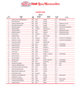
Entrylist [JP] [EN] |
Routeinfromation [JP] [EN] |
Routedistination [JP] [EN] |
Outline [JP] [EN] |